Routes
Check the routes
To unify all the interesting trails originating in the municipality of Riópar (Albacete) or its surroundings, the Riópar Trail Network (RSR) has been created. This set of routes is intended for hikers of all levels, and mountain bikers in some cases, that cover the most interesting areas of this sector of the Sierra del Segura region. With more than 200 km of trails in total, this network will allow us to explore a large part of the Calares del Mundo and de la Sima Natural Park, a provincial (and national) treasure.
Below, we've provided the recommended and most requested routes, along with the download link for the track. You can also find more routes at https://www.riopar.com/programs/red-de-senderos-de-riopar
Most of the routes can be started from our accommodation, so in many of them you do not need to travel by car.
Route No. 1: Riópar – Fuente Grande – Old Riópar – River of the Vega – Riópar (RSR 3.6).
Route type: circular
Distance: 13.7 km
Positive elevation gain: 386 m
Approximate walking time: 3-4 hours (one way)
This is a route of low technical difficulty, ideal for families or mountain biking. It's also one of the best routes to begin exploring the municipality of Riópar, as it covers a large part of the town. The high promontory of Riópar Viejo offers exceptional views of the surrounding area, including the valley of the Río de la Vega, the gigantic Calar del Mundo, located in the Calares del Mundo y de la Sima Natural Park, the Cuerda de la Almenaras, the Padroncillo, La Sarga, and other iconic peaks in the area.
Along the way, we'll walk through the large pine forests that populate the northern slope of this large valley and also through the narrow corridor of riverine forest of the small Río de la Vega. Part of this section is covered by long wooden walkways that cross the wetlands adjacent to the river, with extensive rush beds and reed beds that are home to a rich birdlife. On the way to Riópar Viejo, we'll stop at Fuente Grande, a riverside setting with a small stream and a curiously shaped fountain. At the start of the trail leading to this spot, there's an interpretive panel with useful information about this little hidden corner of the forest.
Download link : https://www.dropbox.com/s/mxx2ak8m14lrebr/Ri%C3%B3par%20-%20Fuente%20Grande%20-%20Ri%C3%B3par%20Viejo%20-%20R%C3%ADo%20de%20la%20Vega%20-%20Ri%C3%B3par%20%28RSR%203.6%29.kml?dl=0
*The title of the brochure is incorrect, but the rest of the instructions are correct*
Route 2: Riópar – Charco de las Truchas – Los Chorros (RSR 2.4)
Route type: linear
Distance: 9.7 kms
Positive elevation gain: 360 m
Negative elevation gain 115 m
Approximate walking time 2-3 hours (one way)
On this route, we'll follow the first stretch of the Mundo River, from the village of Riópar to its source in Los Chorros. This river trip is also suitable for cycling. At certain times of the year, flooding can prevent the route from being completed, as it is necessary to cross the river. Along the way, we'll see how the vegetation gradually changes, from the open spaces near the village of Riópar to the shady forests of the Los Chorros cirque. We'll also visit the small Charco de las Truchas, an ideal place to rest by its clear waters.
Download link: https://www.dropbox.com/s/v1emtsyf3e1l8ov/Ri%C3%B3par%20-%20Charco%20de%20las%20Truchas%20-%20Los%20Chorros.kml?dl=0
*Personally, we like to recommend this route combined with the following one*
Route 3: Riópar – San Juan Camp – Puerto del Arenal – Los Chorros (RSR 2.2)
Route type: linear
Distance: 10.4 km
Positive elevation gain: 473 m
Negative elevation: 229 m
Approximate walking time: 2-3 hours (one way)
This is one of the most popular routes in the area, ideal for any time of year, as the destination is the source of the Mundo River, which never loses its appeal. On the way to this natural refuge, we can see the great slope of Calar del Mundo and the river valley in its first stage. Near the source, we will enjoy splendid views of the Los Chorros cirque and the upper part of Calar del Mundo, noting the marked contrast between the lush valley floor and the rocky heights.
Download link: https://www.dropbox.com/s/e3bqgjkem579av0/Ri%C3%B3par%20-%20Campamento%20de%20San%20Juan%20-%20Puerto%20del%20Arenal%20-%20Los%20Chorros.kml?dl=0
Route 4: Puerto del Arenal – Torca de los Melojos (RSR 3.1 )
Type: Linear
Distance: 8.8 km
Positive elevation gain: 396 m
Negative gradient: 127 m
Approximate walking time: 3-4 hours (one way)
*This route can be shortened if started from the Fuente de las Raigadas*
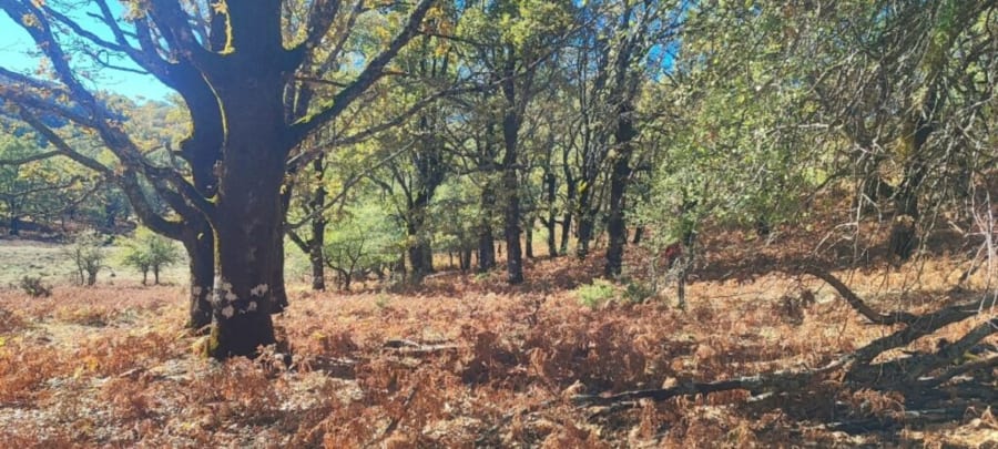
A highly recommended route, especially in autumn, when the colorful spectacle of the Torca de los Melojos takes place (starting in mid-November), lending a special magic to this enclave. We are located at an altitude of approximately 1,400 meters, surrounded by centuries-old Pyrenean oak trees that form an isolated forest within the vast karst surface of Calar del Mundo.
During the hike, we will cross the northwest slope of Calar del Mundo, the most lushly vegetated, passing through large pine and holm oak forests, the famous Cañada de los Mojones (a huge polje), with its unusual pine pastures, the wetland communities of Fuente de las Raigadas, and, finally, the Torca de los Melojos, one of the finest examples of the Pyrenean oak forest in the southern Iberian Peninsula. Located in a large torca or sinkhole, one of the largest in the Calar del Mundo, this forest, although small, transports us to distant places more typical of the northern Iberian Peninsula. From the top of Calar, we have excellent views of the western part of the Sierra del Alcaraz and the mountain ranges of the neighboring province of Jaén.
Download link : https://www.dropbox.com/s/uyk735xuu3ffoeq/Puerto%20del%20Arenal%20-%20Torca%20de%20los%20Melojos.kml?dl=0
La Loma Rural Houses
